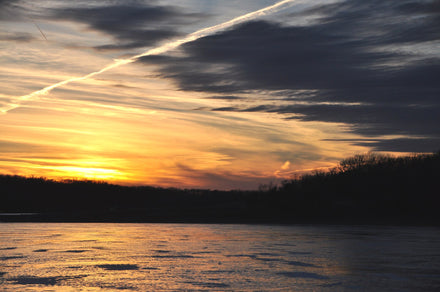
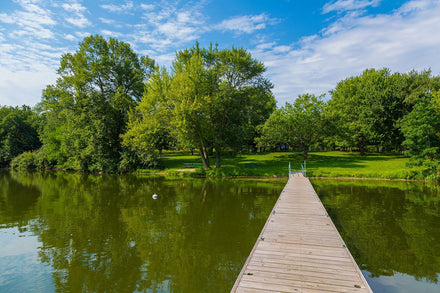
Mississippi sits at the intersection of four major water stories: a 2,300-mile river that has shaped North American history, a Gulf Coast stretching 44 miles of barrier-island-sheltered sound, a string of Army Corps reservoirs in the hill country, and a pair of clear-water rivers in the piney woods that the guidebooks still have not fully discovered. Most visitors who paddle Mississippi head straight for the big obvious names. The better move is to understand what each water body actually is, and pick the one that matches your skill level and the time of year. Fall is the answer to both questions.
What nobody tells you about paddling Mississippi
The state's biggest water, the Mississippi River itself, is not where you paddle. The current runs 4 to 6 miles per hour on an average day, commercial barges generate four-foot standing waves, and there is nowhere safe to land between the rip-rap revetments lining both banks. Any paddle guide that lists the main channel as a destination is telling you to do something dangerous. Ignore it.
What Mississippi actually offers paddlers is everything around and apart from that river: inland reservoirs with calm coves and early-morning glassy conditions, a Gulf Coast system of protected back bays and tidal bayous, and two of the most underrated clear-water rivers in the South. The access is good, the crowds are thin compared to Florida or Tennessee, and fall brings conditions that match anything in the country.
Central Mississippi: Ross Barnett Reservoir
The reservoir locals call "the Rez" holds 33,000 acres of impounded Pearl River water within 20 minutes of downtown Jackson. It is the paddling headquarters for central Mississippi and earns the designation on its merits.

Lake Harbor Launch (Moss Lake/Pipeline Trail)
Put-in: Lake Harbor Boat Launch, Harbor Lane off Highway 43, Brandon. Concrete ramp with a courtesy dock. From the ramp, go left into the residential channels.
Parking: Free at the ramp itself. The Pearl River Valley Water Supply District charges $5 per vehicle at Lakeshore Park (Bobby Cleveland) and Old Trace Park; an annual pass costs $30. Confirm current fee status at therez.ms.gov before your trip.
Route: Paddle through the residential canal network into the lotus-filled Spring Lake Slough, then north toward the area locals call Pelican's Roost, where White Pelicans and various herons congregate. The loop through the slough and back to the ramp runs about two hours at an easy pace. Stay within the channels on the north end to keep away from powerboat traffic on the main lake.
Gotcha: The open main lake turns into a motorboat and water ski zone on summer weekends. Plan for coves and channels only unless you are comfortable with wakes. Afternoon southerly winds build fast on the open water. Some algae blooms appear in late summer; check the PRVWSD website for current advisories.
Best time: Before 9am on summer weekdays; fall and spring for full flexibility. The lotus fields peak in late July and August.
Carter Creek Trail
Put-in: Same Lake Harbor Boat Launch. Paddle south and under the highway into Carter Creek rather than north toward the slough.
Route: A wooded creek corridor with good wildlife (herons, kingfishers, turtles). Longer than the Moss Lake loop and more demanding balance-wise as the creek narrows. Suitable for paddlers who have handled a board before.
Source: Pearl River Keeper (pearlriverkeeper.com) maintains the best community route maps for the Rez; worth downloading their paddle trail PDFs before your trip.
South-Central Mississippi: Okatoma Creek
Okatoma Creek is Mississippi's best-kept paddling secret. A spring-fed, sandy-bottomed flatwater river running through Covington County, it runs clear and cool even in August when every reservoir in the state has turned green and soupy. The Okatoma Outdoor Post outfitter (okatoma.com) operates from the Sanford Bridge area and handles the logistics: rent equipment, get shuttled upstream, and float back at your own pace through longleaf pine and hardwood corridor with turtles in the shallows and otters along the banks.
Put-in: Outfitter launches from Sanford Bridge area via a flat bank entry. The shuttle is included with any rental; for independent paddlers with their own board, confirm access directly with the outfitter.
Route: Class A flatwater with a gentle downstream current. Trip lengths vary; most half-day floats cover 5 to 8 miles. The sandy bottom is shallow enough to see easily, wide enough for a board, and forgiving for a first river experience. Watch for the occasional log jam requiring a short drag-around.
Gotcha: After heavy rainfall, Okatoma rises quickly and current becomes fast with strainers. Do not paddle it after significant rain without checking conditions with the outfitter first. Summer low water (August and September) is actually the best SUP window: the creek drops to knee-deep in places, you can read the bottom clearly, and the current is gentle. Water levels in spring can be brisk for a first board trip.
Best time: Late summer (August to September) for low, crystal-clear conditions ideal for inflatable boards; fall for cooler temperatures; spring for higher flows if you want more current. Call ahead: okatoma.com lists current conditions.
North Mississippi: Army Corps Reservoirs
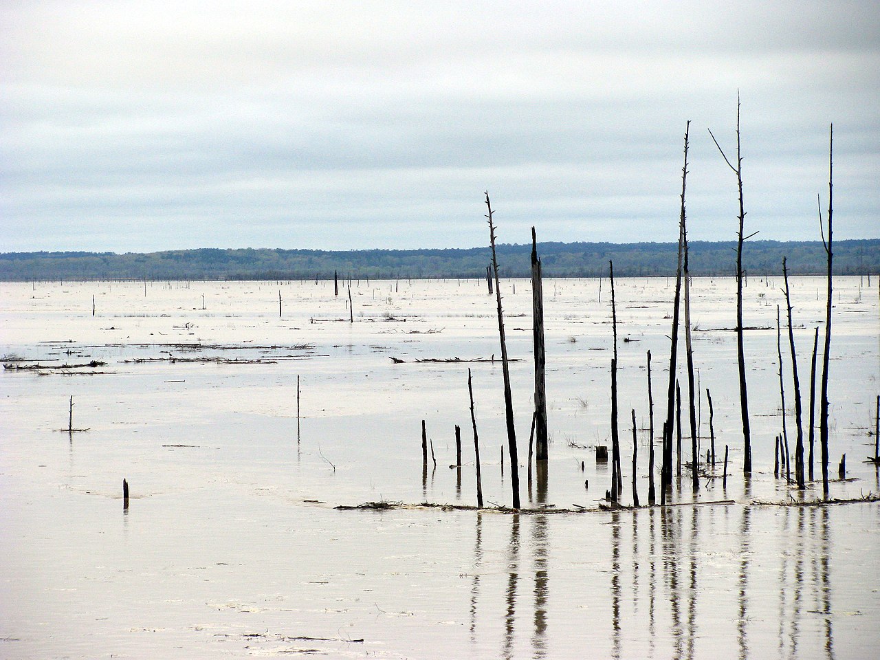
Three large Army Corps reservoirs form a chain across north Mississippi: Grenada Lake (36,000 acres), Enid Lake, and Sardis Lake. They share the same character: expansive open water with sheltered creek arms that are entirely manageable on a board, heavy boat traffic in summer on the main lake, and honest conditions when the wind comes up. All three accept the America the Beautiful Annual Pass and the USACE Annual Day Use Pass ($40) for boat ramp access.
Grenada Lake (Grenada County)
Put-in: The Army Corps Vicksburg District manages 15 boat ramps at Grenada Lake. Confirmed ramp areas include North Abutment, North Graysport, South Abutment A and B, Torrance Extended, and Bryant. Project address: 2202 Scenic Loop 333, Grenada, MS. Day-use pass ($5) available at recreation.gov (Grenada Landing A Day Use Pass) or on-site at the ramp. America the Beautiful Pass accepted.
Route: The upper Yalobusha River arm at the north end is calmer and more sheltered than the main lake body. Head up the creek arm and away from the open expanse for your best quiet-water paddling.
Gotcha: The main lake is serious wind exposure. Grenada is a flood-control reservoir and water levels fluctuate with Army Corps operations; check before a trip. Heavy crappie-fishing boat traffic during spring spawning season (March to May) can feel overwhelming on the open water. Call the project office at (662) 226-1679 for current conditions.
Best time: Early weekday mornings in spring and fall. Grenada Outdoor Outfitters serves this area if you need equipment.
Enid Lake (Yalobusha County)
Put-in: Most ramps charge $5 per day; the Bynum Creek ramps are confirmed free. America the Beautiful Pass accepted at fee areas.
Best time: Spring and fall; weekday mornings only. Late summer algae blooms are common; check MDEQ advisories before paddling.
Sardis Lake (Panola County)
Put-in: Engineer Point Recreation Area on the south end has a confirmed boat ramp and day-use facilities. Day-use pass at recreation.gov (search AP2994) or on-site. America the Beautiful Pass accepted.
Gotcha: Sardis can hold enormous flood control volumes and then drop dramatically; exposed mudflats at low pool are not paddling conditions. Confirm water levels before the drive.
Northeast Mississippi: Pickwick Lake (JP Coleman State Park)
Pickwick Lake occupies the northeast corner of the state where the Tennessee River forms the border with Alabama. It is a different kind of Mississippi water: cold, deep, and clear, managed by TVA rather than Army Corps. JP Coleman State Park (near Iuka) sits on the Mississippi shore and offers the best base for paddlers.
Put-in: JP Coleman State Park boat ramp at the park campground. Day-use fee: $2 per person (confirm current rate at mdwfp.com). A public free ramp also exists near Iuka at approximately 34.8878 N, 88.0999 W.
Route: Paddle from the state park into the protected coves along the Mississippi shore. Morning calm on Pickwick in September and October is among the best flat water in the state. An annual Paddles on Pickwick event (hosted by Tishomingo County Tourism, typically September or October) draws local paddlers and is a good introduction to the lake community.
Gotcha: Pickwick is an active commercial navigation channel for Tennessee River barge traffic. The main navigation channel runs down the center of the lake; stay in the coves and near-shore areas and clear the channel markers. Summer weekend boat traffic is heavy. Fall weekdays are the move.
Best time: September and October for fall foliage, calm mornings, and sparse boat traffic.
North Mississippi: Wall Doxey State Park (Holly Springs)
Wall Doxey is a small, quiet CCC-era park 7 miles south of Holly Springs, built around 60-acre Spring Lake. It is not a destination for experienced paddlers looking for distance; it is the perfect first-board lake in north Mississippi.
Put-in: Within the park on Spring Lake. Day-use fee: $4 per vehicle.
Route: Paddle the 60-acre lake at whatever pace you need. The 2.5-mile nature trail circles the shore; you can paddle while other visitors walk. The water is calm and protected. Kayaking is confirmed as an activity at the park.
Best time: Spring and fall; weekdays. Located on Highway 7.
Gulf Coast: Ocean Springs and Back Bay of Biloxi

The Mississippi Gulf Coast runs 44 miles from the Louisiana border to the Alabama line. The barrier island chain (Cat, Ship, Horn, Petit Bois) sits 10 to 12 miles offshore and provides some shelter from Gulf swells, but the Mississippi Sound between the mainland and the islands is still open water that requires weather judgment. The smart move for most paddlers is the protected back bays and tidal bayous rather than the open Sound.
Ocean Springs Harbor and Davis Bayou
Put-in: Ocean Springs Harbor, east end of Front Beach, Ocean Springs. Launch from the beach or harbor ramp area. One mile east, Davis Bayou (Gulf Islands National Seashore headquarters) offers protected bayou paddling on NPS land.
Route: From the harbor, explore Biloxi Bay to the west or head east into Davis Bayou and Old Fort Bayou for protected backcountry paddling. The bayou network connects to Marsh Point and the Biloxi River Marshes Coastal Preserve. SUP rentals are available locally through Wild Flier and Paulou's in Ocean Springs; confirm current hours before your visit.
Gotcha: The open Biloxi Bay and Mississippi Sound are not beginner waters in any wind above 10 miles per hour. Stay in the bayous unless conditions are glassy. Commercial shrimping boat traffic in the harbor requires attention at the launch. Afternoon thunderstorms develop daily from May through September.
Best time: Early morning, year-round. Fall and spring for the best overall conditions. Summer mornings before 9am can be glassy and warm on the protected back bays.
Back Bay of Biloxi
Back Bay sits between downtown Biloxi and the mainland to the north. More protected than the open Sound, it offers miles of calm water for paddlers who want saltwater conditions without Gulf exposure. Tidal influence is present; consult NOAA tide charts for the Biloxi station before your paddle. Watch for oyster reefs at low tide, which can catch a SUP fin in shallow water.
Pascagoula River Area (Presley's Outing)
Put-in: Presley's Outing, 10402 Presley's Outing Road, Moss Point, MS. Sand beach launch into Franklin Creek, a protected tidal creek off the Pascagoula River. The Boathouse Restaurant is on-site. The DMR Paddle the Gulf program has used this as an event venue; call ahead to confirm current conditions and any access fee.
Route: Paddle about 1 mile down to Franklin Creek and explore its sheltered channel through Jackson County marsh. Total out-and-back is approximately 5 miles with multiple good stopping points along the banks. The creek is one of the most wildlife-rich in the county (herons, egrets, alligators, otters).
Gotcha: Tidal. Check NOAA tides for the Pascagoula station before going; paddling against an outgoing tide in a narrow creek is a workout. Wildlife includes alligators; give them wide berth and do not paddle directly between a gator and its bank. Never approach closely.
South Mississippi: Black Creek (De Soto National Forest)
Black Creek carries a National Wild and Scenic River designation through the De Soto National Forest in Perry and Forrest Counties. The designation is earned: sandy bottom, clear water, mature longleaf pine forest on both banks, and a current gentle enough for inflatable boards in normal flow. It is Mississippi's best-kept paddling gem for those willing to look past the reservoirs.
Put-in: Multiple Forest Service access points in De Soto National Forest. Black Creek Canoe Rental in Brooklyn, MS operates shuttles; confirm current schedule and pricing directly with the outfitter.
Route: Linear float with outfitter shuttle return. Multiple trip lengths are available. The classic paddle takes you through the National Forest on clear, sandy-bottomed water with a pace your board can handle easily on normal-flow days.
Gotcha: Like Okatoma, Black Creek rises fast after rain and develops strainers and fast current that make it unsuitable for boards. Check with the outfitter for current conditions before booking. Summer low water can require dragging your board through shallow sections; the outfitter will advise on current float-ability.
Best time: Spring for good water levels; fall for cooler temperatures and fall color; late summer in normal rainfall years for clear, low water.
Safety and legal requirements
PFD requirements
Mississippi law requires every person on a vessel to have access to a U.S. Coast Guard-approved wearable PFD. Adults 13 and older must carry one aboard; it does not have to be worn, but wearing it is always the right call, especially on moving water or in cold conditions. Children 12 and under must wear a Type I, II, or III PFD at all times while underway on a vessel under 26 feet. On Gulf Coast Personal Watercraft (PWCs), all riders must wear a PFD. Source: Mississippi DMR (dmr.ms.gov).
Registration and boating education
Non-motorized vessels, including stand-up paddleboards, kayaks, and canoes, do not require registration in Mississippi. The state's boating education certificate requirement also does not apply to non-motorized vessel operators of any age. If you add a trolling motor to a kayak or board, it becomes a motorized vessel and registration is required. Source: MS DMR and MDWFP-approved boat-ed.com.
Aquatic invasive species
Mississippi does not currently have a mandatory Clean-Drain-Dry statute comparable to Minnesota or Wisconsin. Regardless, you should clean, drain, and dry your board, fins, leash, and paddle between water bodies. Hydrilla is a significant issue in several north Mississippi reservoirs; carrying it between lakes on unwashed equipment is exactly how infestations spread. Confirm current Mississippi AIS rules at mdwfp.ms.gov.
Gulf Coast paddling specifics
The Mississippi Sound and coastal waters fall under Mississippi Department of Marine Resources jurisdiction. Standard PFD rules apply. Before any Gulf Coast paddle, check the NOAA Marine Forecast for Gulf zones ANZ080 through ANZ085 (weather.gov or the NOAA Weather app). Tidal predictions for the Biloxi, Pascagoula, and Bay St. Louis stations are at tidesandcurrents.noaa.gov. Afternoon thunderstorms develop daily from May through September and can arrive within minutes of a clear sky; if you hear thunder, get off the water immediately.
Best seasons for Mississippi paddling
Fall (September to November) is the answer. Air temperatures drop to comfortable 70 to 85 degrees, water is still warm from summer storage, humidity falls after Labor Day, the daily thunderstorm season mostly ends by mid-September, and powerboat traffic drops dramatically. Pickwick in fall foliage, Okatoma in October with clear low water, and Ross Barnett before dawn in September are all genuinely outstanding.
Spring (March to May) runs a close second. Good water levels on the moving-water spots (Okatoma, Black Creek), migratory birds at the reservoirs, and wildflowers in the pine forest. Watch for afternoon thunderstorms, which start in April and build to daily by May.
Summer (June to August) is possible but the heat and humidity demand respect. Mississippi summers regularly push the heat index above 105 degrees by midday. Paddle before 9 or 10am only, carry significantly more water than you think you need, and wear sun protection. The Gulf Coast back bays can be glassy and bath-warm early on summer mornings and are genuinely enjoyable in that narrow window.
Winter (December to February) is underrated on the Gulf Coast. Water temperatures stay 50 to 62 degrees even in cold snaps; air temperatures on clear winter days can be pleasant for paddling. A wetsuit is advisable for anything below 60 degrees water. Inland reservoirs and rivers are colder (40 to 55 degrees) and cold-water immersion risk increases substantially; dress for the water temperature on any winter inland paddle. Crowds are essentially nonexistent.
Permits, fees, and passes
- Ross Barnett Reservoir: PRVWSD charges $5 per vehicle at Lakeshore Park and Old Trace Park; $30 annual pass available at therez.ms.gov or the PRVWSD Main Office (6018 Lakeshore Park, Brandon, MS 39047, Monday to Friday 8am to 5pm). Other launch points may vary; confirm at therez.ms.gov.
- Army Corps reservoirs (Grenada, Enid, Sardis): $5 per day at most ramps. The America the Beautiful Annual Pass ($80 at nps.gov/passes) and the USACE Annual Day Use Pass ($40 at recreation.gov) both cover Army Corps day-use fees at all of these lakes. Enid Lake's Bynum Creek ramps are free.
- Wall Doxey State Park: $4 per vehicle day-use fee.
- JP Coleman State Park (Pickwick): $2 per person day-use fee; confirm current pricing at mdwfp.com.
- De Soto National Forest (Black Creek): Generally free for dispersed recreation on National Forest land. Confirm with the De Soto NF Ranger District before your trip.
- Gulf Coast access points: Confirm specific launch access and any parking fees locally; coastal access points vary.
Linking out: more Gulf and Deep South paddling
Mississippi sits between some of the country's most rewarding paddling destinations. Paddleboarding in Louisiana covers the bayou country, Lake Pontchartrain, and the Gulf Coast from Slidell west. Paddleboarding in Alabama takes Pickwick Lake from the eastern shore and adds the Gulf Coast from Gulf Shores west. Paddleboarding in Tennessee covers the rest of Pickwick plus the Upper Cumberland and Tennessee River lakes. Paddleboarding in Arkansas covers the Ozark lakes and Buffalo National River country to the northwest. The full national guide lives at Best Places to Paddleboard Across the USA.
Frequently asked questions
Do I need to register a paddleboard in Mississippi?
No. Mississippi requires registration only for motorized vessels and sailboats. Non-motorized human-powered vessels including stand-up paddleboards, kayaks, and canoes are fully exempt from registration and from the state's boating education certificate requirement. Source: MS DMR, dmr.ms.gov.
Do I need to wear a life jacket on a paddleboard in Mississippi?
Adults 13 and older must carry a U.S. Coast Guard-approved PFD on the board, but are not required to wear it (except on PWCs). Children 12 and under must wear a Type I, II, or III PFD at all times while underway. Wearing your PFD at any age is the right call, especially on moving water, cold water, or coastal conditions where a fall can put you far from your board quickly.
When is the best time to paddleboard in Mississippi?
Fall, specifically September through November. Comfortable air temperatures in the 70s and 80s, water still warm from summer, humidity down after Labor Day, and powerboat traffic a fraction of the summer numbers. Spring (March to May) is the second-best window. Summer requires an early start; stop by 10am.
Where should a beginner paddleboard in Mississippi?
Ross Barnett Reservoir near Ridgeland and Brandon is the top beginner destination in central Mississippi, with multiple calm coves, an outfitter community, and easy-to-find launches. Okatoma Creek near Seminary is ideal for a first river experience, especially with outfitter support and shuttle service. Wall Doxey State Park near Holly Springs offers a quiet 60-acre lake for true first-timers in north Mississippi. On the Gulf Coast, Davis Bayou at Ocean Springs and the protected portions of Back Bay of Biloxi are the calmest saltwater entry points.
How much does it cost to launch at Ross Barnett Reservoir?
The Pearl River Valley Water Supply District charges $5 per vehicle at Lakeshore Park (Bobby Cleveland) and Old Trace Park. An annual PRVWSD vehicle pass is $30. Some other launch points may be free; confirm at therez.ms.gov or by calling the PRVWSD main office.
Is Okatoma Creek good for paddleboarding?
Yes, especially for inflatable boards. It is a Class A flatwater river with gentle current, crystal-clear water, and a sandy bottom. Outfitter shuttle service makes it accessible even without previous river experience. Check conditions before going, especially in spring when water levels can rise quickly after rain. The Okatoma Outdoor Post (okatoma.com) is the main outfitter and can advise on current float conditions.
Do the north Mississippi Army Corps lakes accept America the Beautiful Pass?
Yes. Grenada Lake and Enid Lake are confirmed to accept the America the Beautiful Annual Pass for day-use fee waiver at boat ramps. Sardis Lake day-use passes are available through recreation.gov. The USACE Annual Day Use Pass ($40) covers all USACE day-use areas nationwide. Sources: USACE Vicksburg District at mvk.usace.army.mil.
Can I paddleboard to Horn Island from the Mississippi Gulf Coast?
Technically possible but not recommended except for experienced sea kayakers with proper navigation equipment, a VHF marine radio, and a weather window. Horn Island is 12 or more miles offshore, across open Mississippi Sound with Gulf swells, commercial shipping traffic, and no bailout if conditions change. Intermediate paddlers should paddle the protected back bays and tidal bayous on the mainland coast instead.